3D SCANNING
Real Estate
Everything you need to knowabout using reality capture in your business.
Is It a Future
Already?
Short answer: Yes.

Professional grade scanners
Scanning with a handheld scanner is blazing fast. You can capture an entire apartment in a couple of minutes. Capturing a 3-story house will take you 15.
Using the scanner requires minimal training and no prior surveying expertise, although you do have to be mindful of potential scanning pitfalls.
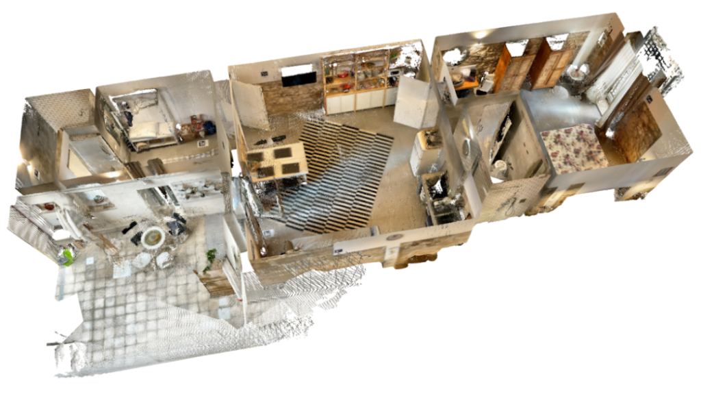
Apart from the speed of capture, the biggest advantage is the precision of data. Based on the scan data you can safely calculate reports compliant with country-specific rules such as the ANSI Z765-2021 or NEN2580.
The most popular choice in this category, the Leica BLK2GO costs around € 50.000. Although on the cheap end in the world of professional scanners, it is a substantial investment.
Additionally, Leica's software is needed to process the raw files from the scanner
Bottom line:
It will significantly cut your time on location, but it's quite pricey.

Mobile apps
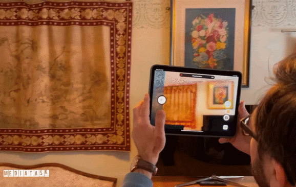
With the introduction of the LiDAR sensor, Apple's iPhone and iPad lineup became a viable option for low-cost 3d scanning.
We recommend the dot3D app, which has a unique set of features tailored specifically for accurately scanning real estate. Most importantly, it supports adding dimensional constraints from external sources, such as your Disto. The app automatically uses these inputs, as well as a clever targeting solution to correct any errors in the scan.
Scanning time is a bit longer than with the BLK2GO, but is still much more efficient than using the traditional methods.
Most importantly, the output point cloud is dense and accurate enough for calculating NEN2580 or ANSI Z765-2021 reports.
The app costs around € 300 for a yearly license with unlimited scans.
Bottom line: A budget-friendly and scalable option that still does the job.
Which one should i choose?
Workflow
Frequent questions, important answers
I'm interested. What's next?
If you're ready to start testing the technology or would like to setup a call to talk with our experts - please feel free to contact us. We're always ready and happy to talk to you!Already a Mediatask customer?
Feel free to also hit that button, or contact your account manager directly!
Interested in the details of scanning with your iPad or iPhone? We have prepared a comprehensive guide that covers every step of the way from prep work, through capturing techniques to exporting and uploading your data. Click the button to get your copy.
More from Mediatask on 3D scanning

Mediatask on LinkedIn: Why Handheld Laser Scanners Are a Game-Changer
When you need a 3d scan of a space and accuracy along with speed of capture are both your top priorities, a hand-held laser scanner can be a great choice.
The BLK2GO is a popular one amongst our clients. No wonder - scanning is much faster than using a tape measure...

Mediatask on LinkedIn: 3D scanning in Amsterdam
With the 3D scanning technology becoming more popular and accessible, real estate marketing is swiftly changing. We'd like to share a success story of our long-term client, who has managed to use this change to their advantage.
Based in Amsterdam, Woning Media Nederland provides top-notch ...

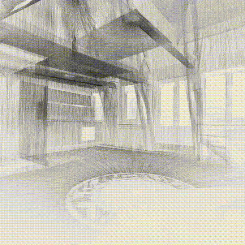
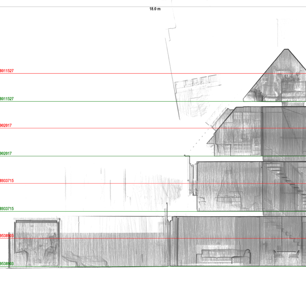
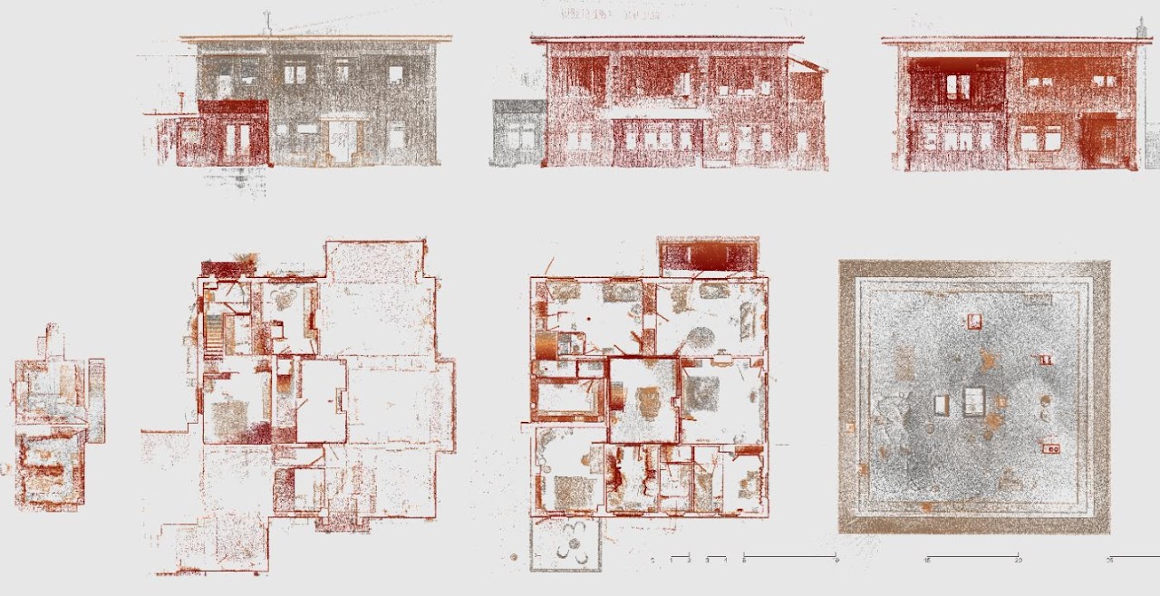
Mediatask on LinkedIn: Cross-sections of buildings scanned with Leica BLK2GO
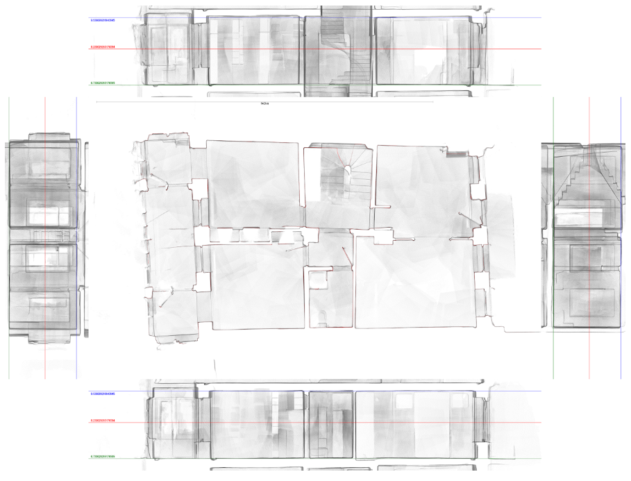
When you work with 3D scans created with Leica's BLK2GO on a daily basis, you can quickly get used to how precise and highly detailed they are. These sections are perfect for drafting, but hey, aren't they also just beautiful?

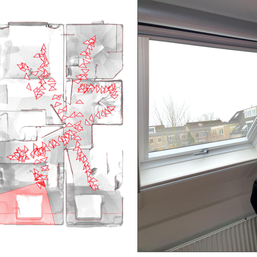
Mediatask on LinkedIn: 3d scanning with Dot3D
Wait till the 5-second mark to see the transition 😎
This scan is not only pretty, but it's also accurate within <2cm tolerance!
Thanks to the clever use of #AprilTag targets and dimensional constraints, the #Dot3D app from DotProduct LLC can create accurate ...